Plan every flight down to the last detail with Skyfish Mission Control™: powerful, easy to use flight planning and navigation software. Mission Control™ is where drone pilots and crews can plan and modify flights and access and manage flight logs.

Mission Control™ connects to Skymind™, our onboard computer with AI-powered flight path and orbit generation, machine vision, and custom sensor API.

Detailed pre-flight checklists to ensure the best flight results and data collection.

Dedicated app gives pilots the same level of control on-the-go.

Pre-flight, in-flight, and post-flight control.

Windows® 10 Support

Skyfish Mission Control™ software has been designed specifically to run on Windows®.

In the field, we’ve optimized the software for our remote controller, providing a ruggedized interface for users.

Skyfish Mission Control™ gives pilots full control over mission planning and terrain assessment, and allows pilots to define unlimited waypoints and camera angles with the tap of a finger.

Our software includes interfaces for flight and orbit planning, map caching and management, craft calibration, photo viewing and storage, drone customization, and other advanced settings.

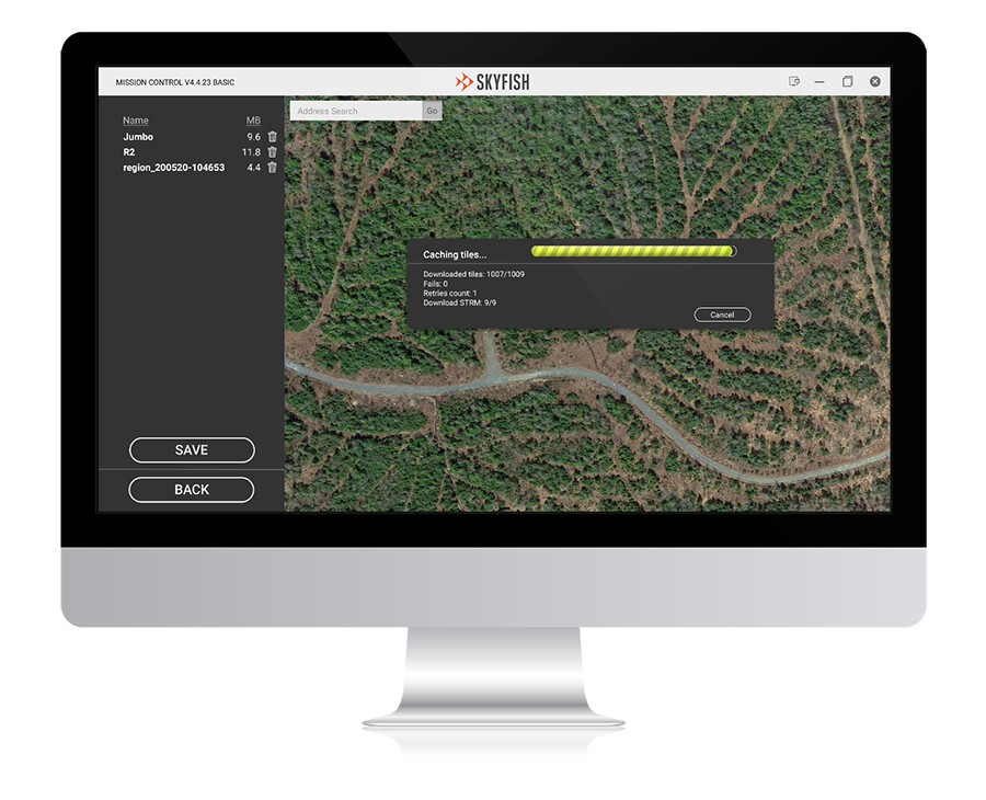
Map Caching & Management

Review flight areas, cache local maps, and ensure flight preparedness.
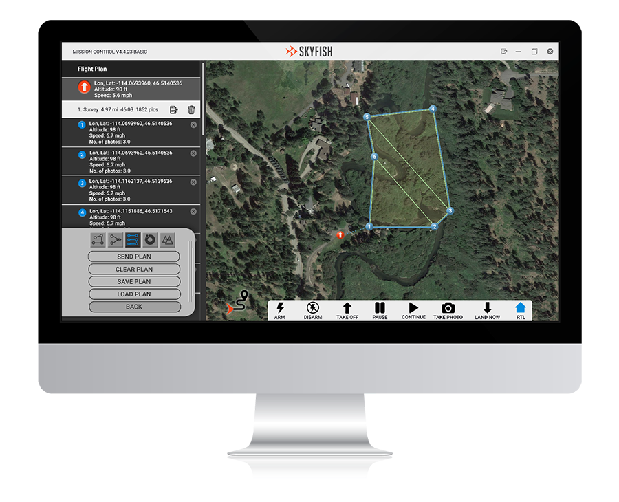
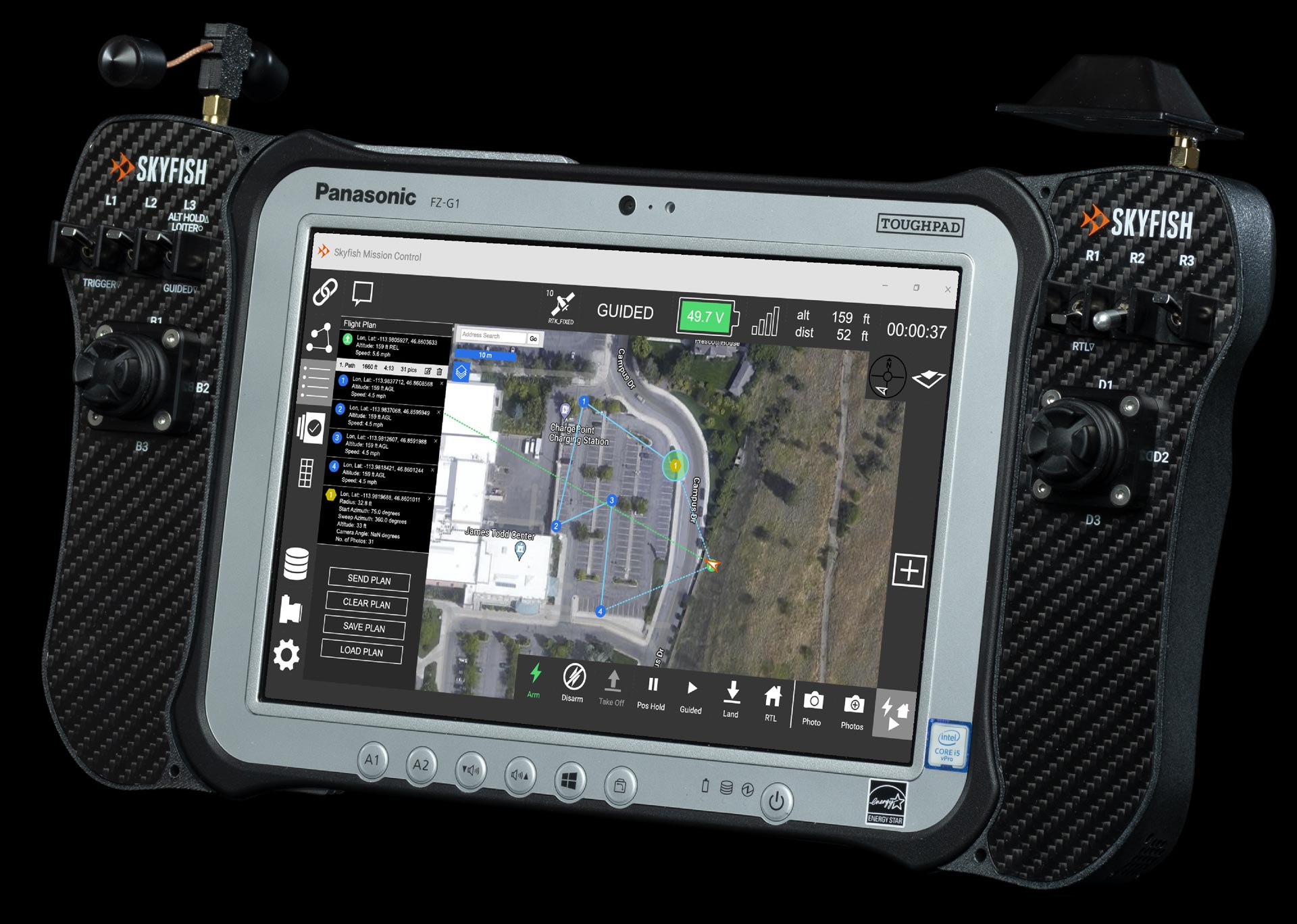
Mission-Control_Map-Caching-and-Management
Mission-Control_Flight-Planning

Flight Planning

Input markers and points of interest. Select flight modes and other customizations.

In-Flight

Watch your drone work through target points and modify flight details as needed.
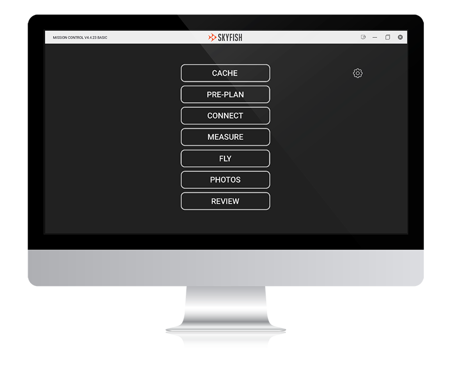
Mission-Control_Post-Flight

Post-Flight

Review and manage flight logs, captured media, profile settings, and KML and various export options.

Go mobile.

The Skyfish drone platform includes a Panasonic® Toughbook™ tablet as your remote controller. Your pilots are good to go in a mobile work environment.

C1 Basic Software Screen

Smarter Drones. High-precision data capture.

AI-driven analysis and asset management in an integrated software suite.

Contact us and discover the industry-leading solution for ultra-precise survey, mapping,
and modeling of target infrastructure.

Contact Us

Hidden
Such as your industry, the number of drones you require and your particular use case.
This field is for validation purposes and should be left unchanged.