Skyportal™ Data Processing & Management
Your empire from 10,000 ft.
Skyfish creates hyper-accurate “digital twin” 3D models using our powerful onboard computer, custom flight software, firmware, sensors, and machine learning. All customer data and models are secure and encrypted in the AWS cloud where teams can manage, mark-up, share, and export their models as required.
- Comprehensive software for data management, analytics, and support.
- Secure digital ecosystem for data storage, browsing, and navigation.
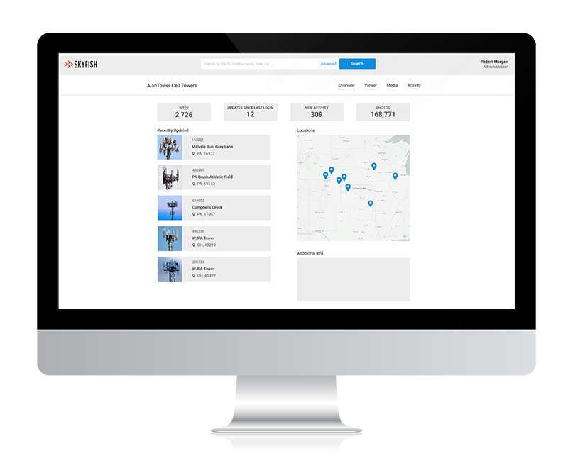
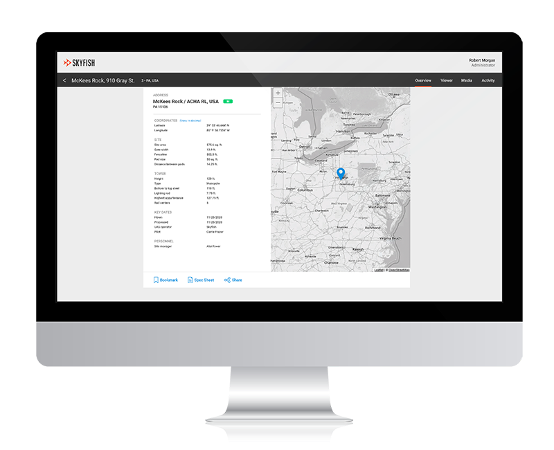
Skyportal™ Dashboard
View all of your sites, updates, activity, media, and more. Share and comment on digital assets within your enterprise and export to other programs.
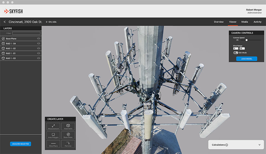
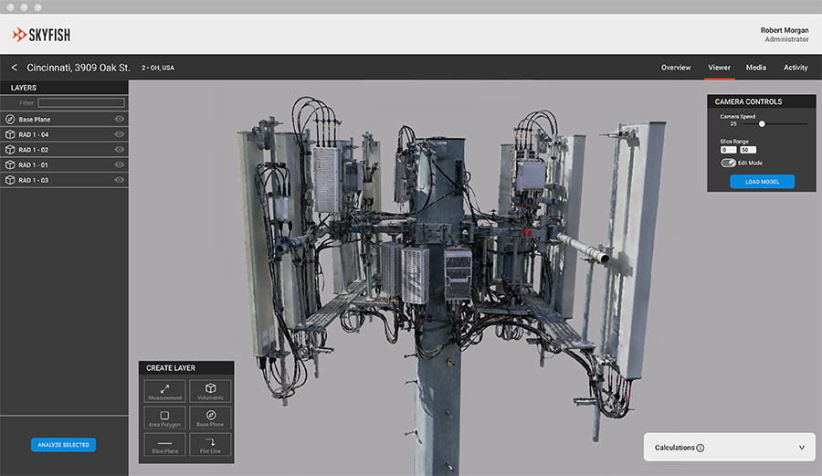
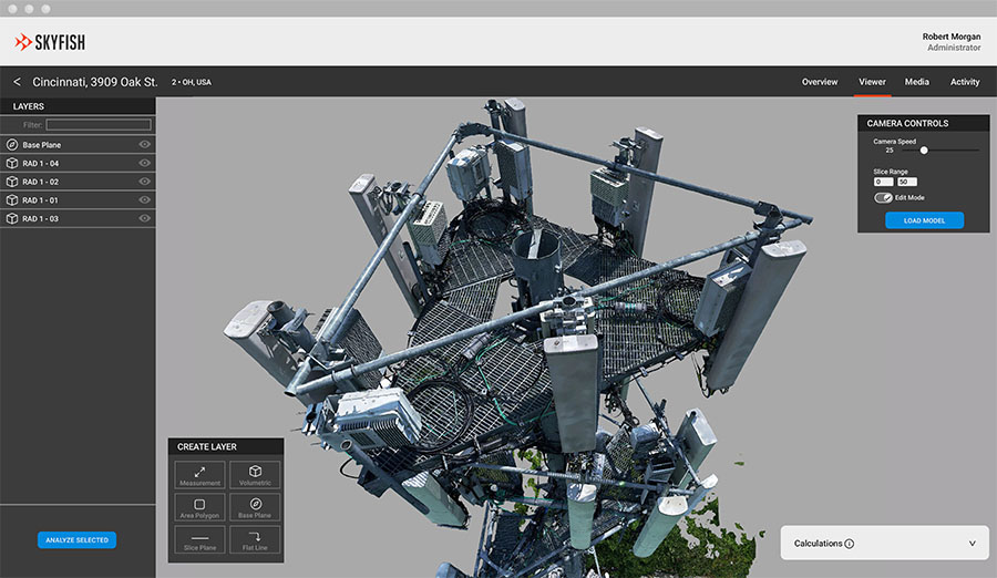
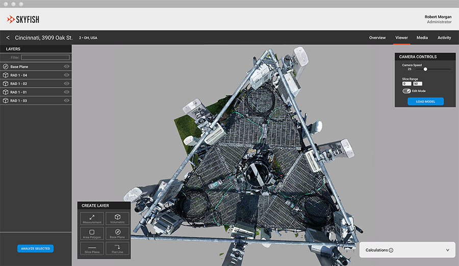
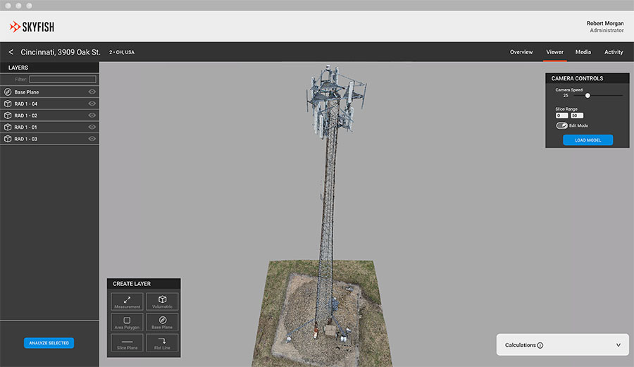
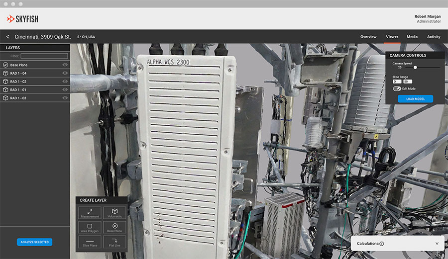
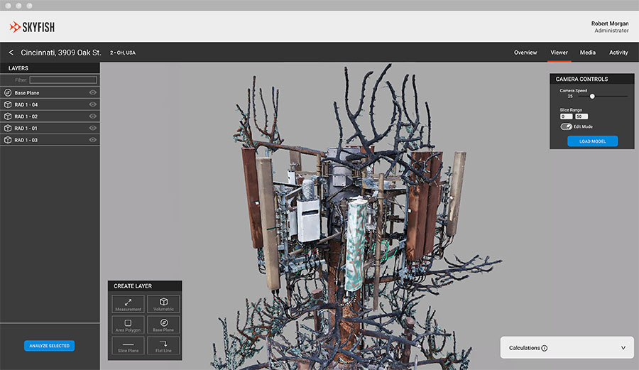
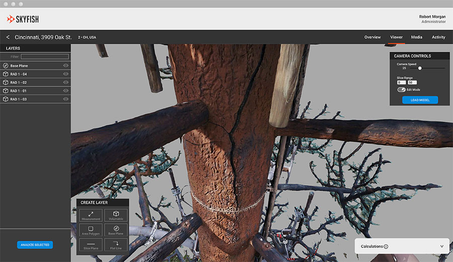
3D Modeling & Mapping
Within hours of flight, Skyfish will generate crystal clear digital twins of your target areas and infrastructure. Tour your digital assets in Skyportal™, edit models, add notes, and export into CAD, Esri, and more for further data analysis. Please ping us for a deep-dive demo of our 3D modeling capabilities.
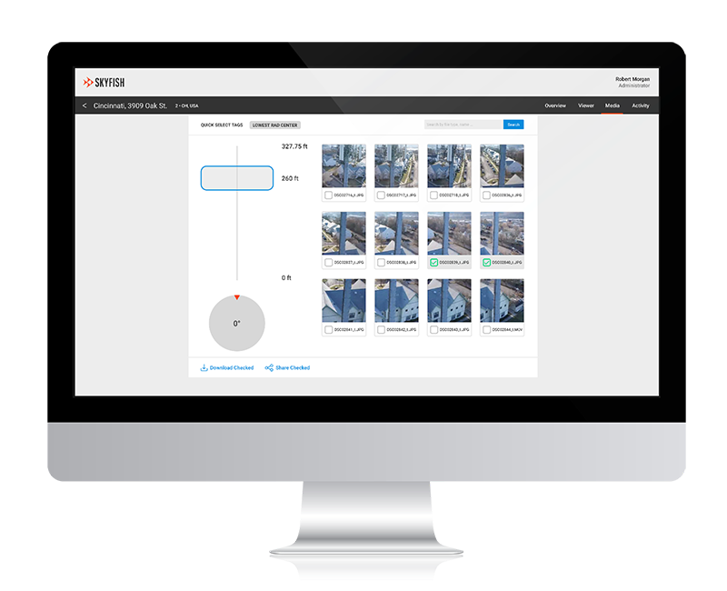
Media
View, manage, download, and share photos and video of your infrastructure. Select, bookmark, and share points of interest.
Analytics
Precise measurements, object recognition, classification, report compilation, and export. Skyportal™ gives you a real handle on your infrastructure inventory.