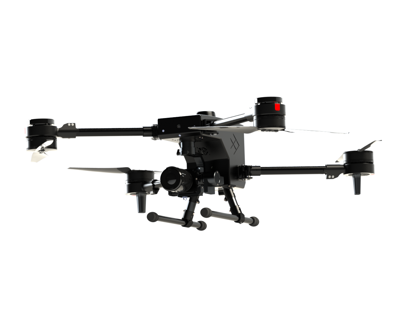
A Lightweight Quadcopter for Survey Grade Inspections & ISR
Skyfish Osprey Drone
The Skyfish Osprey professional drone is purpose built for to inspect critical infrastructure and for Intelligence, Surveillance and Reconnaissance (ISR). Get powerful and timely information from a drone that is small, smart, and ready to scale.

High Resolution
Up to 61 megapixels for inspection and photogrammetry

~15 lbs
All Up Weight

Precision for Every Location
Every frame automatically geotagged with time, date and highly accurate RTK locations

Piloting Flexibility
Autonomous / manual flight modes


Flight Times
Up to 30 minutes (45 minutes expected in early 2026)
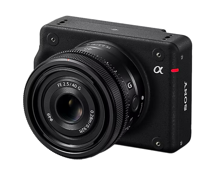
SONY ILX-LR1
for Inspection & Photogrammetry
- 61-MP camera
- Full frame image sensor
- Interchangeable e-mount precision lenses
- Remote operation
- 35mm full-frame back illuminated Exmor R™ CMOS image sensor
- Natural gradations and realistic colors
- Wide ISO range of 100-32000
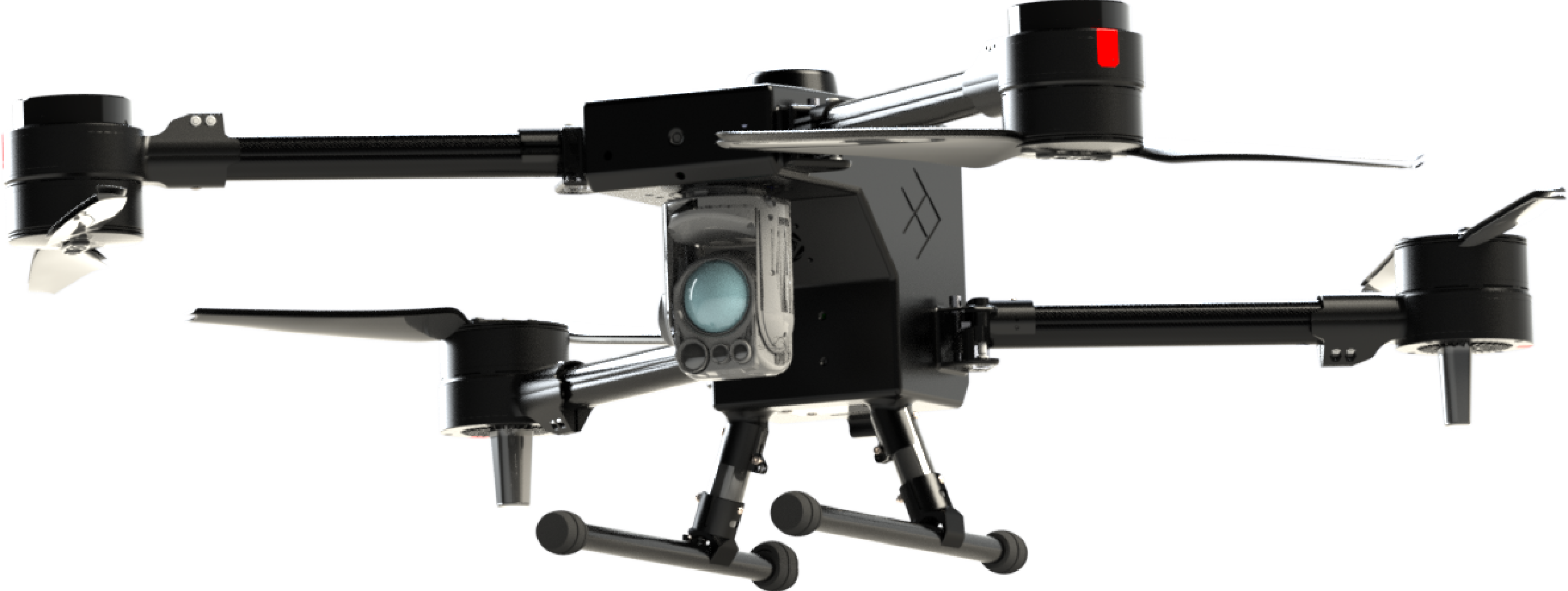
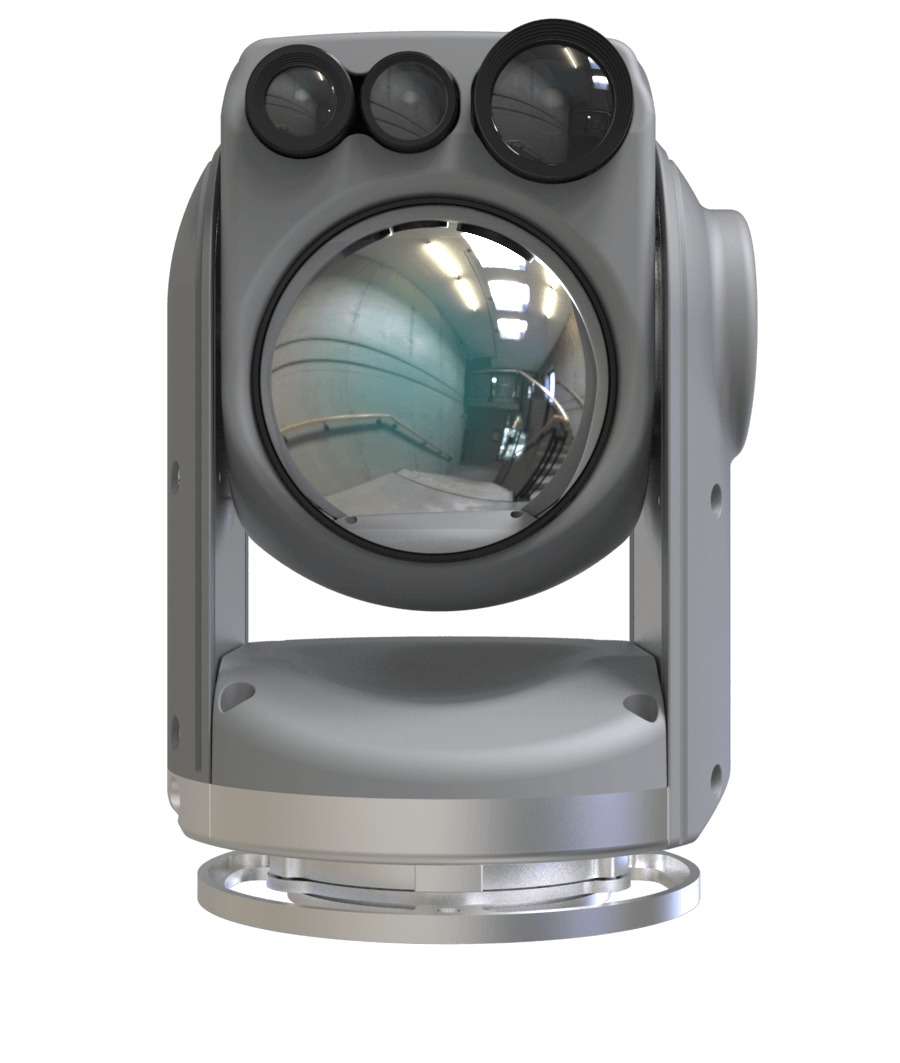
NextVision Raptor
for Intelligence, Surveillance and Reconnaissance (ISR)
- X80 EO zoom (X40 + X2 digital)
- Significant IR range
- Rainproof
- Day, low-light, and night-time capabilities ranging from Near-Infrared (NIR) to Long Wave Infrared (LWIR) imaging
Lightweight Professional Quadcopter
Osprey features at a glance
- Best-in-class sensor: Sony Alpha ILX-LR1and lenses, integrated with drone and ground control station
- Long range radio (3 miles, depending on the environment)
- 15 lb all up weight, compact, portable
- Collision avoidance available Q2 2026
- Automated in-flight precision geotagging
- Location, time, and date score
- RTK, sub 1-3 cm accuracy
- Support for photogrammetry and infrastructure inspection missions
- Made in USA, NDAA compliant
d into every frame for synchronous data
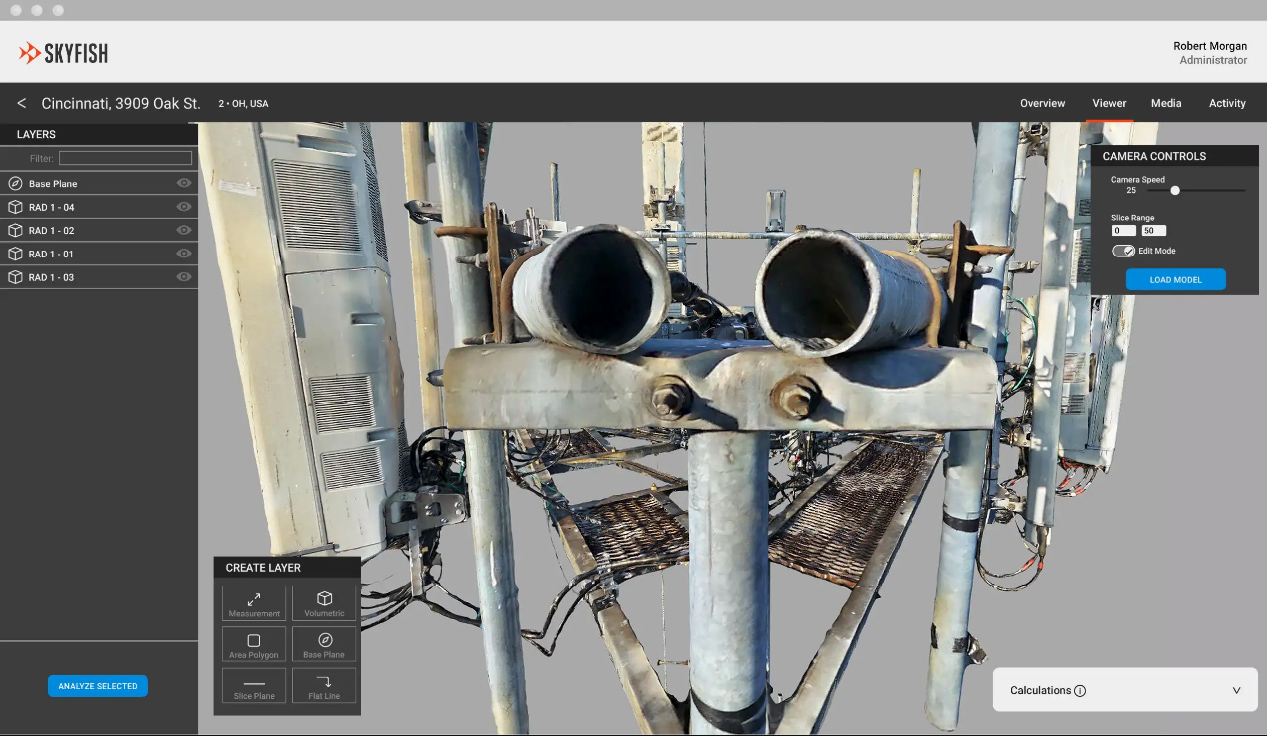
Better photos create better models
Photogrammetry | Digital Twins
Using sophisticated algorithms, Skyfish extracts the exact, minute, detailed features from thousands of photos, correlates and triangulates these features, then warps and stitches the photos seamlessly into high fidelity 3D reality models. Skyfish offers a fully integrated online portal (Skyportal) for customers to view the digital twins.
The result is an exact life-like replication, or “digital twin” of the target infrastructure. The 3D model is so detailed you can measure the thickness of steel, measure a cotter pin in a bolt, or the length of a cable to sub-centimeter accuracy inside the model.
Longer battery life
Flies Longer
Complex missions can be accomplished with fewer battery changes in the field. Osprey can be configured to fly for up to 30 minutes (45 minutes expected in early 2026), depending on the battery selected. The radio range is 3 miles.

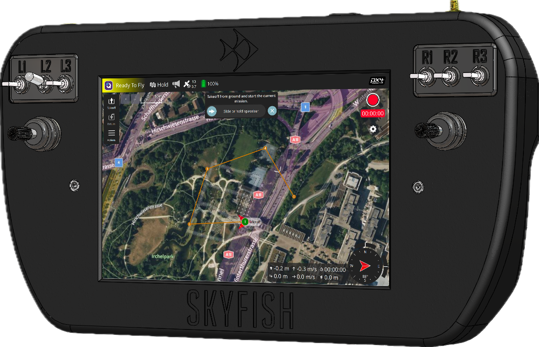
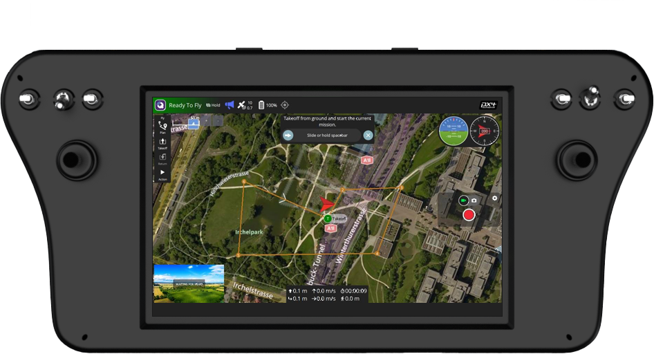
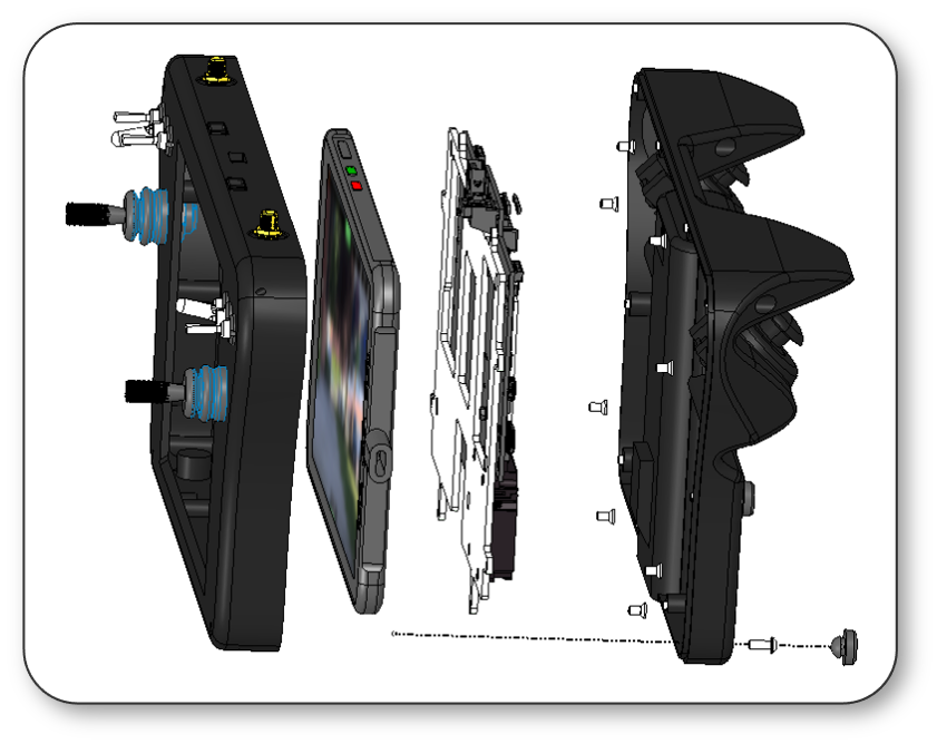
QGroundControl
Ground Remote Control
Skyfish has customized QGroundControl for flight navigation and integrated it with our proprietary ground control station. The Talon remote controller runs on the same NVIDIA processor as the Skyfish Osprey drone, ensuring seamless interoperability, fewer parts, and simplified maintenance. Our custom-designed PCB removes tablet limitations, maximizes processing power, and provides the flexibility to meet specific customer requirements.
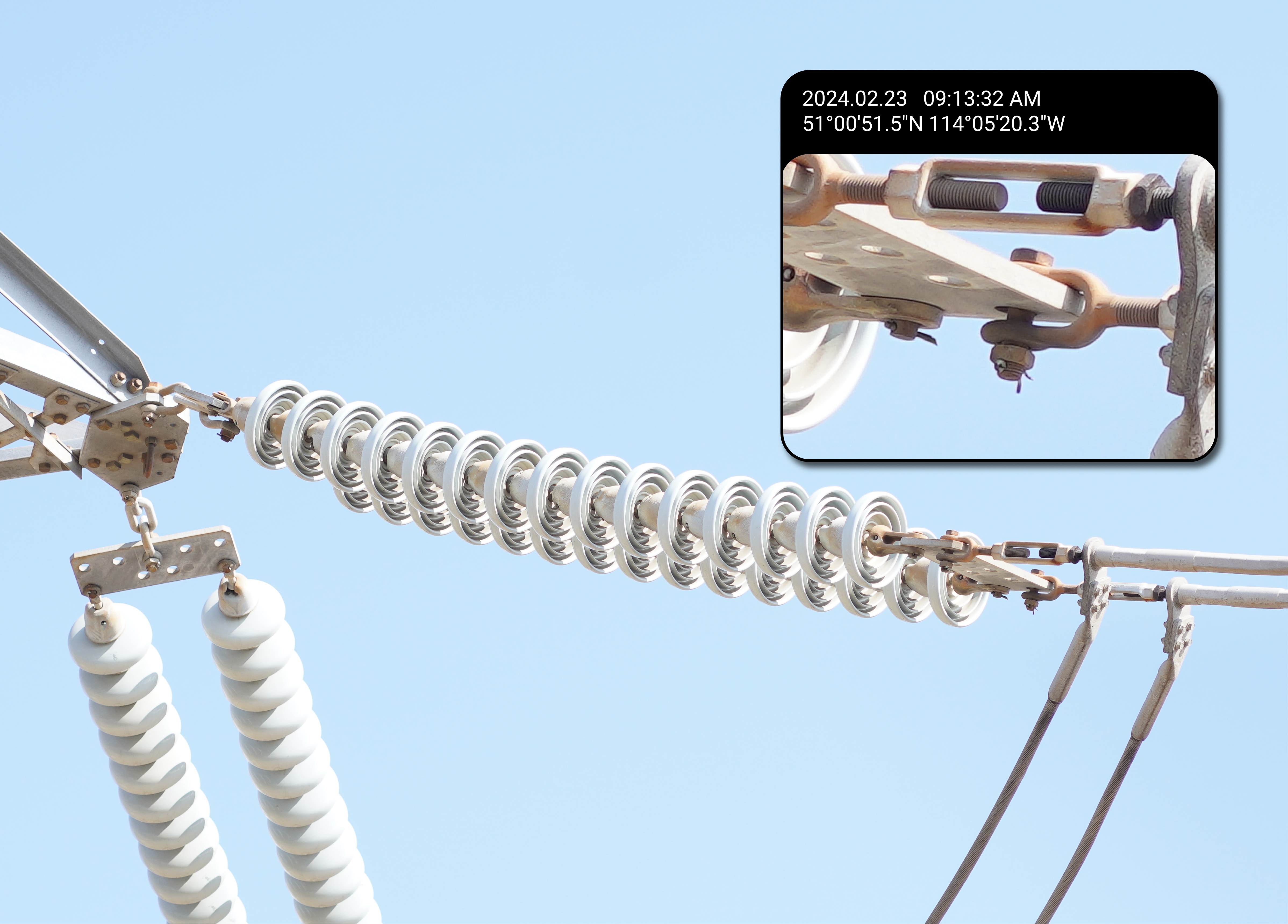
Geotagging every frame
Best in Class Location Accuracy
Best-in-class location accuracy The Skyfish platform has amazing location accuracy with an automated geotagging process that is frame synchronous. We inject highly accurate data into every still frame on the Sony LR1. The Osprey also uses an onboard RTK GPS solution with a stand-alone RTK Base Station (optional). The base-station is survey grade, and can act as a relay to increase the range as required.
American Made
Made in the USA and NDAA compliant
Based in Missoula, MT, Skyfish designs drones, battery systems, airborne guidance, and ground control stations, which provide real-time video and telemetry feeds from the aircraft – all in house, for the past 12 years. Skyfish is fully made in the USA and is NDAA compliant.