Motor Redundancy to Ensure Payload Safety
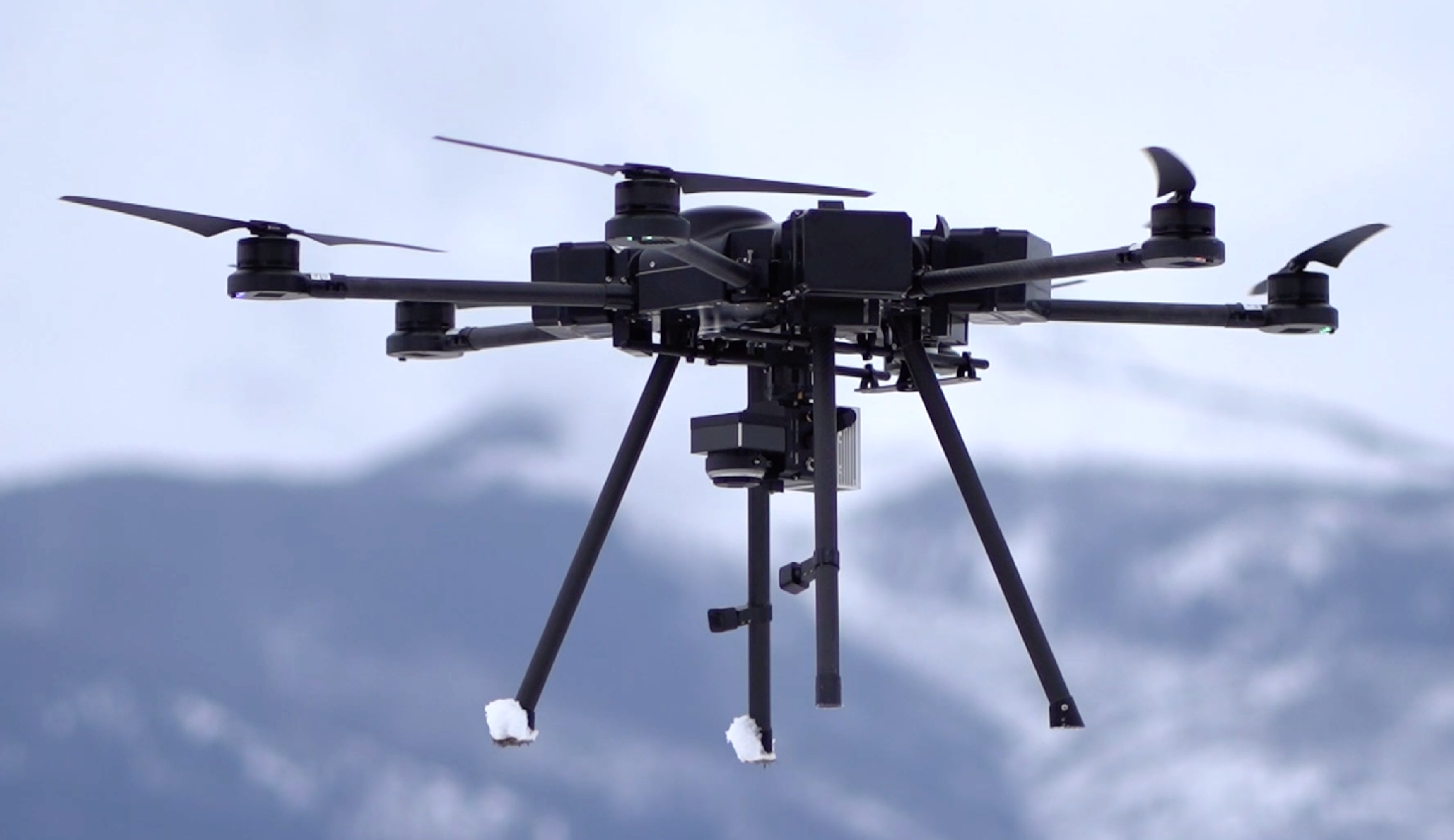
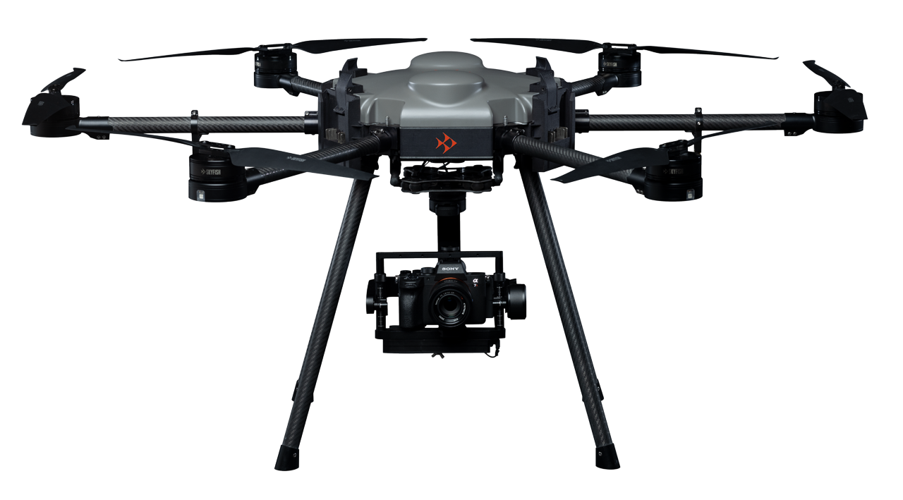
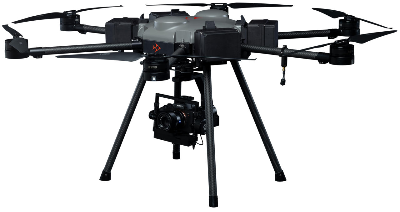
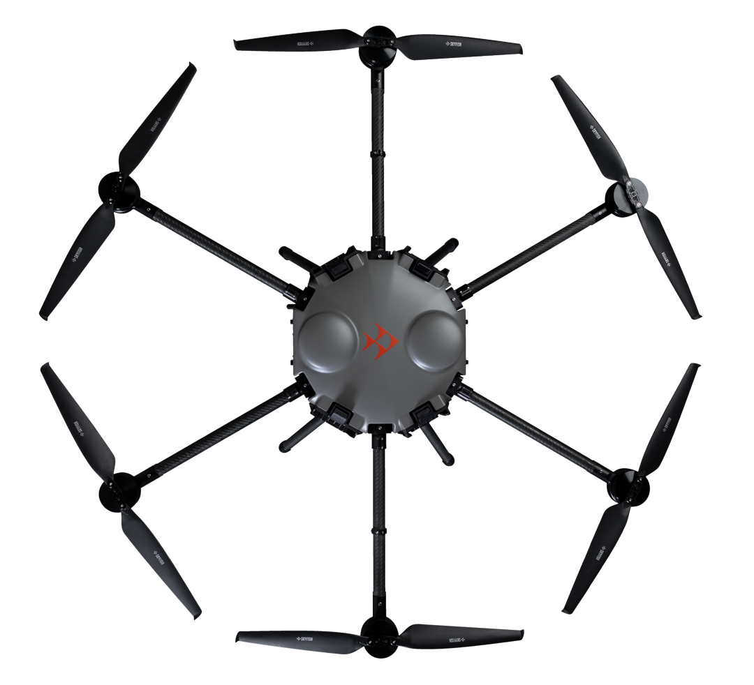
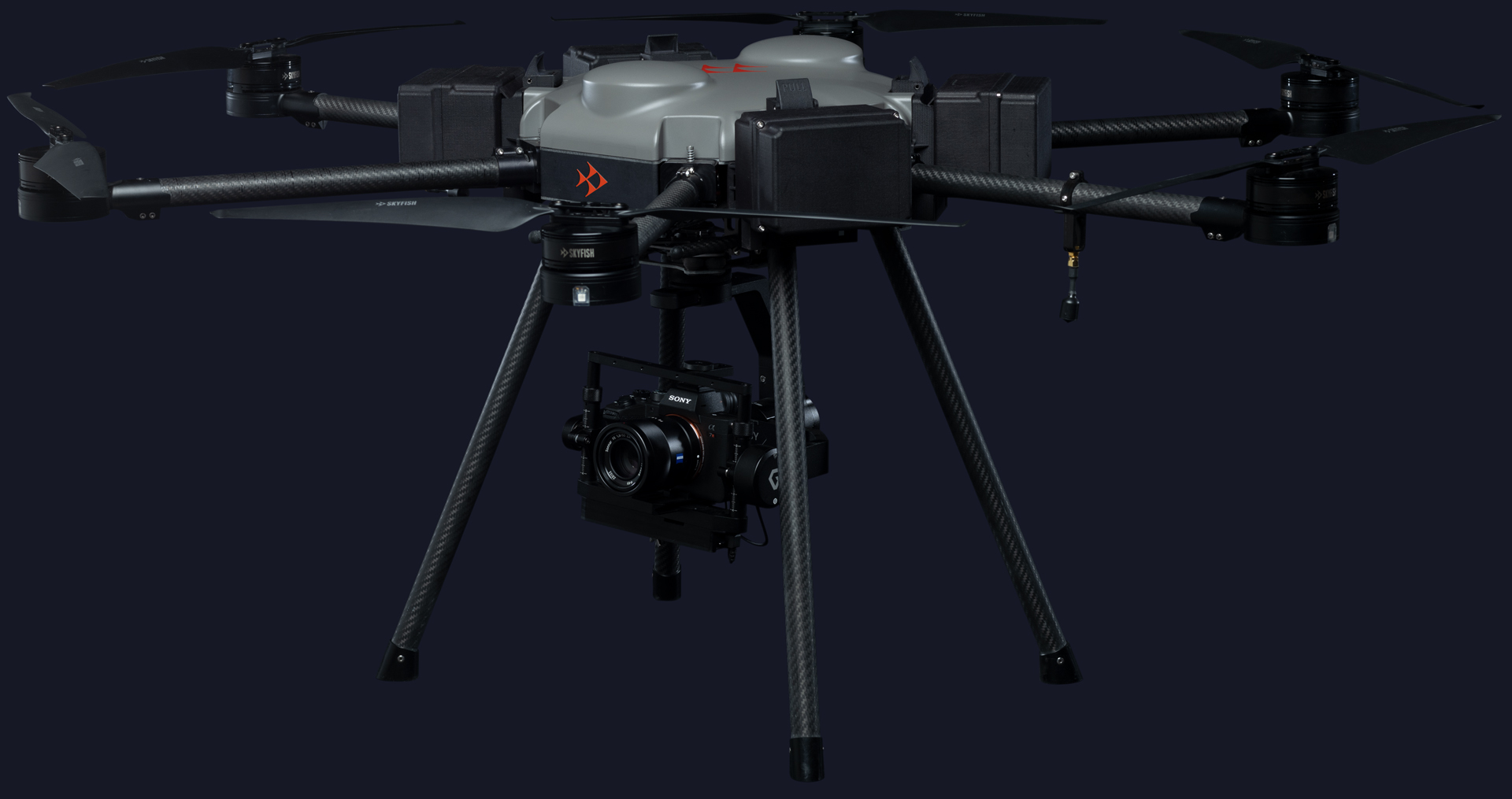
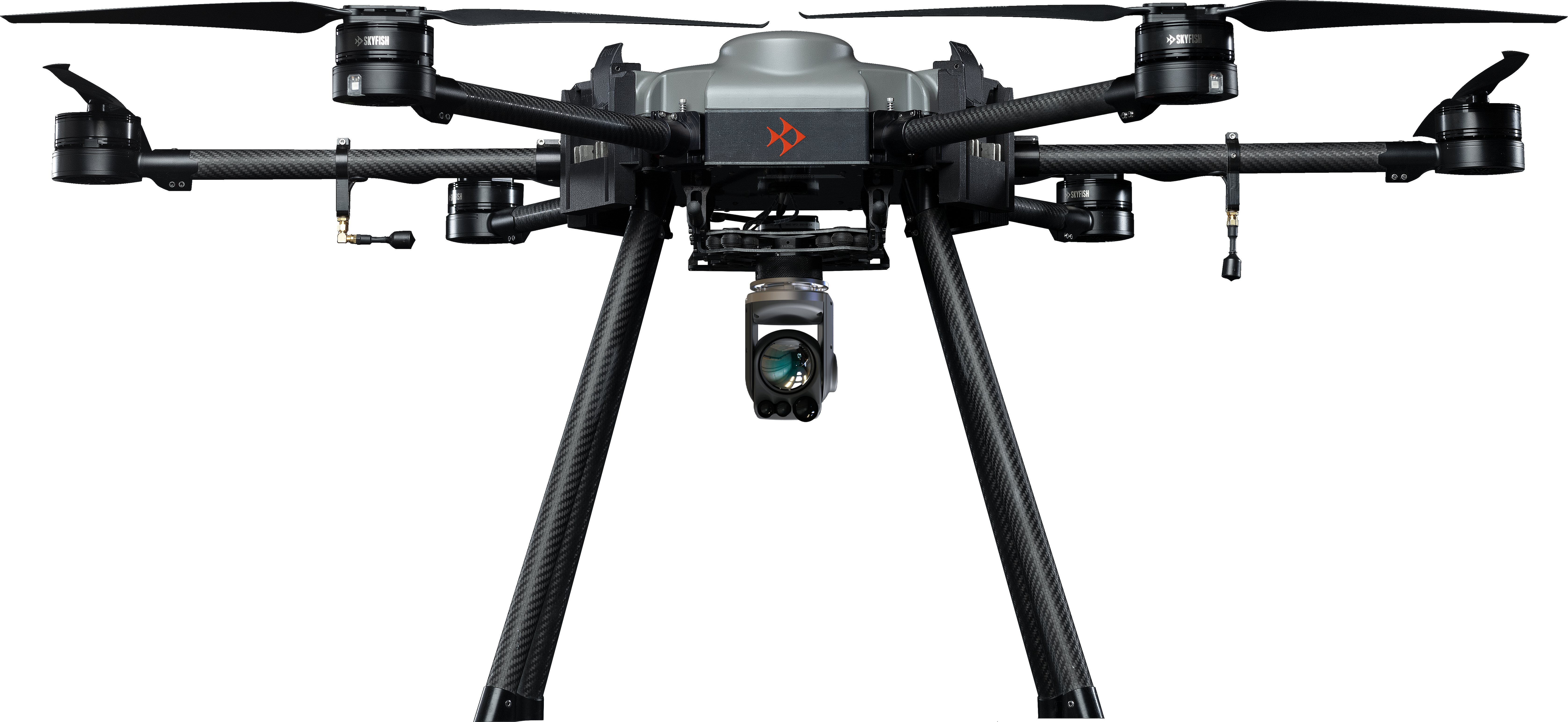
Skyfish M6 Heavy Lifting Drone
The Skyfish M6 (6-rotor) drone is a heavy-lift hexacopter designed for commercial applications such as infrastructure inspection, 3D modeling, LiDAR, infrared missions, gas detection, and robotic interactions. It is engineered for rapid deployment with a 2 minute set-up time and easy “pack and go” transportation. Smart drones like the M6 enable ultra-precise data capture and AI-driven analysis for industrial workflows.
Drone for Lifting Heavy Expensive Payloads
Engineered for the toughest missions.
- Foldable carbon polymer construction with 6 motors.
- Supports the Sony Alpha series of cameras for up to 61 megapixels of capture, as well as thermal and LiDAR.
- 45 mph top speed, powered by long-lasting Li-Ion batteries.
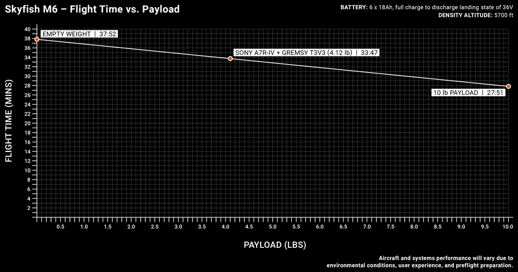
- Capable of carrying 10 lbs for 30 minutes.

Battery Life
500+ cycles per pack

Flight Time
25-35 minutes, depending on battery
selected

Top Speed
Up to 45 mph

Piloting Flexibility
Autonomous / manual flight modes

High Resolution
Up to 61 megapixels

Sensors
Full-sensor compatibility

RTK locations
Highly accurate RTK locations
Drone with LiDAR
The Power of LiDAR
Harness the power of cutting-edge drone technology paired with LiDAR systems to supports infrastructure inspections, surveying, precision measurements, high-resolution mapping and geospatial data collection. Skyfish can provide a power drop for the following LiDAR payloads out-of-the-box and can integrate new payloads quickly.
- Riegl MiniVux2
- Phoenix Ranger UAV Lite
- GeoCue TrueView
- RockRobotics R2A
- Custom please inquire
Trust the M6 Drone for your Mission
Redundant Power Systems
The M6 commercial drone has a redundant power system, meaning that the craft can lose a motor due to mechanical failure and still successfully land keeping your payload safe.
Flight Times
Drone that Flies Longer
Flight times on the M6 with a lidar unit ranges from 25-35 minutes depending on weight, environmental factors, and battery selected.
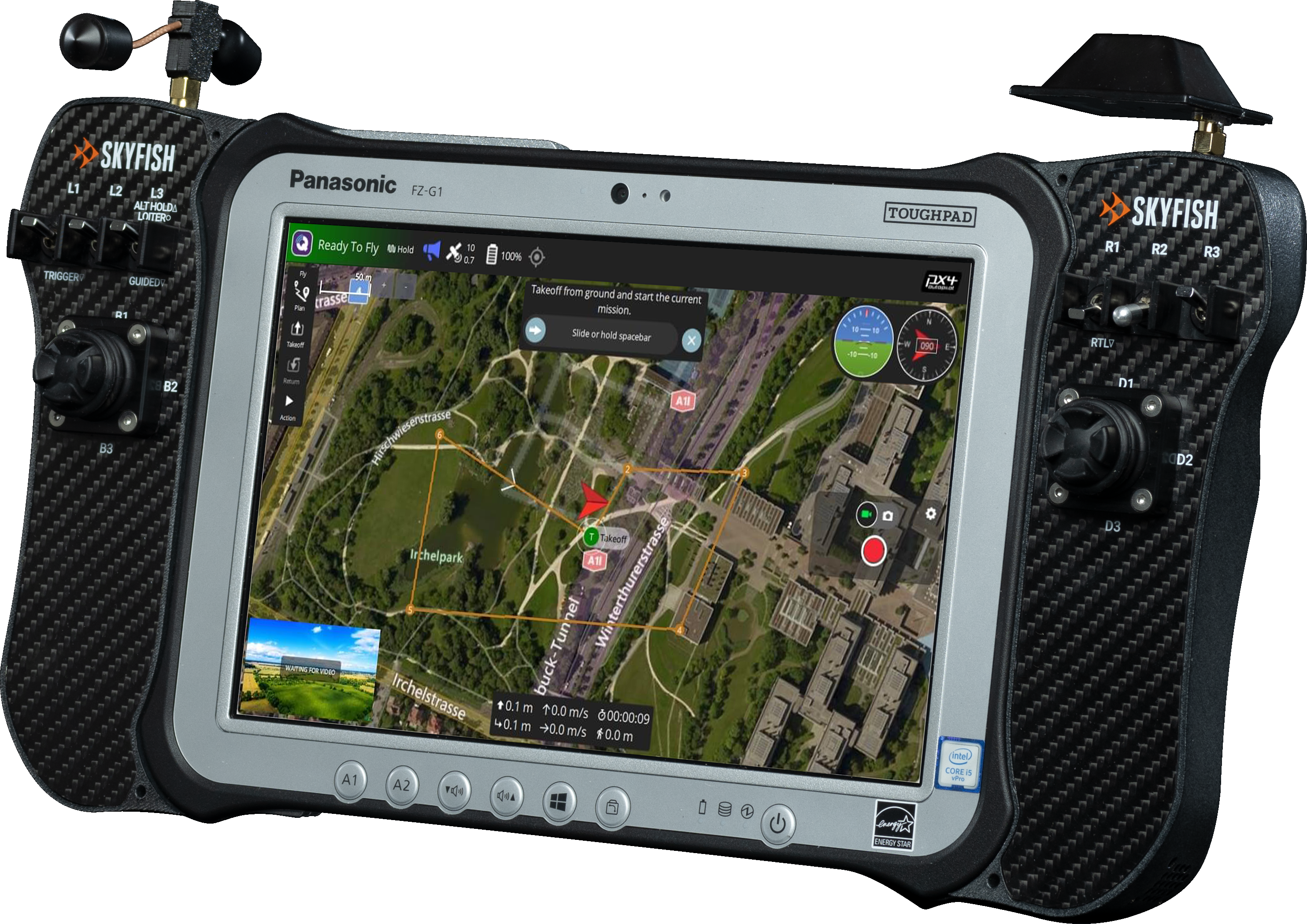
Easily Navigate Your Mission
Complete Control
Skyfish customized QGroundControl for flight navigation and is integrated with our proprietary remote controller. The controller features a Panasonic tablet and offers an 8″ or 10″ screen for viewing of real-time video feeds and 4 joysticks (2 for navigation, 2 for sensor control).
American Made
Made in the USA and NDAA compliant
Based in Missoula, MT, Skyfish designs drones, battery systems, airborne guidance, and ground stations, which provide real-time video and telemetry feeds from the aircraft — all in house, for the past 10 years. Skyfish is certified Airworthiness Level 3 by U.S. Army DevCom and Green UAS (in process).