Photogrammetry
Digital Replica of Your Site
Skyfish uses sophisticated algorithms to extract minute features from each inspection photo, correlate and triangulate these features, and warp and stitch the photos seamlessly into high fidelity 3D reality models.Better Photos Make Better Models
One of our secrets to exceptional models, is taking exceptional photos. Skyfish’s Osprey drone is specifically designed for photogrammetry and is tightly integrated with the SONY ILX-LR1 61-MP camera to deliver the best digital twins available on the market.
Location Accuracy
We guarantee accurate meta-data is collected and injected into every image and geotagging is based on a proprietary Skyfish sub system that offers a 30hz frame synchronous injection circuit. As part of the process, our flight software dynamically generates an optimized flight path so the drone can capture the right image, in the right location, with the right pose.
Digital Dashboard for 3D Modelling
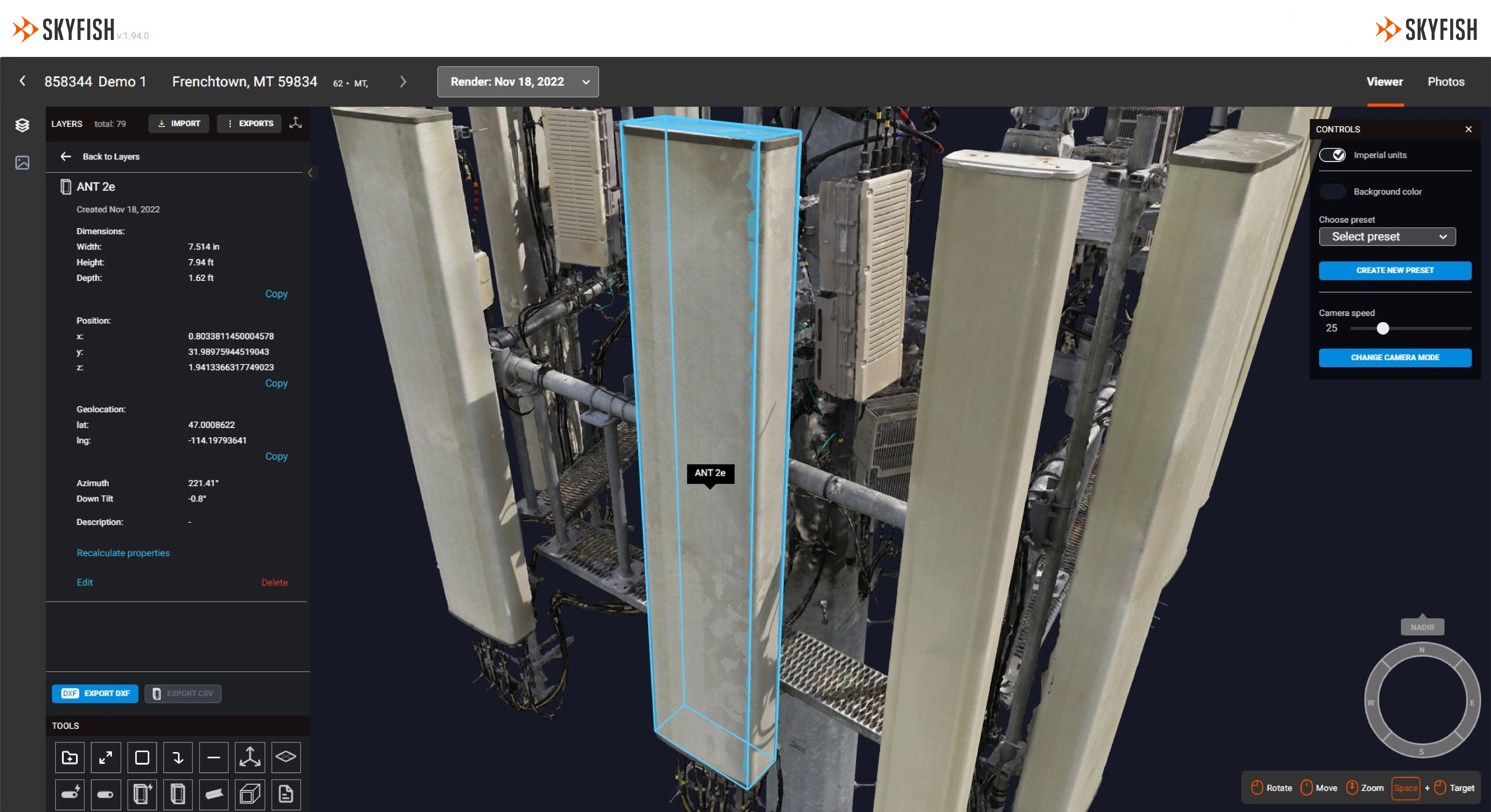
Skyportal™
Post flight, the captured data is uploaded to Skyportal™, our rendering, viewing, and AI engine. Rendering can be automatically initiated, resulting in complete models within hours of collection.
Digital twin of your infrastructure
Highly Precise 3D Models
Using sophisticated algorithms, Skyfish extracts the exact, minute, detailed features from thousands of photos, correlates and triangulates these features, then warps and stitches the photos seamlessly into a lifelike replication (digital twin) of target infrastructure.
Using AI to Understand Infrastructure
Skyportal™ uses machine learning to auto-detect and identify elements of infrastructure in the 3D model.
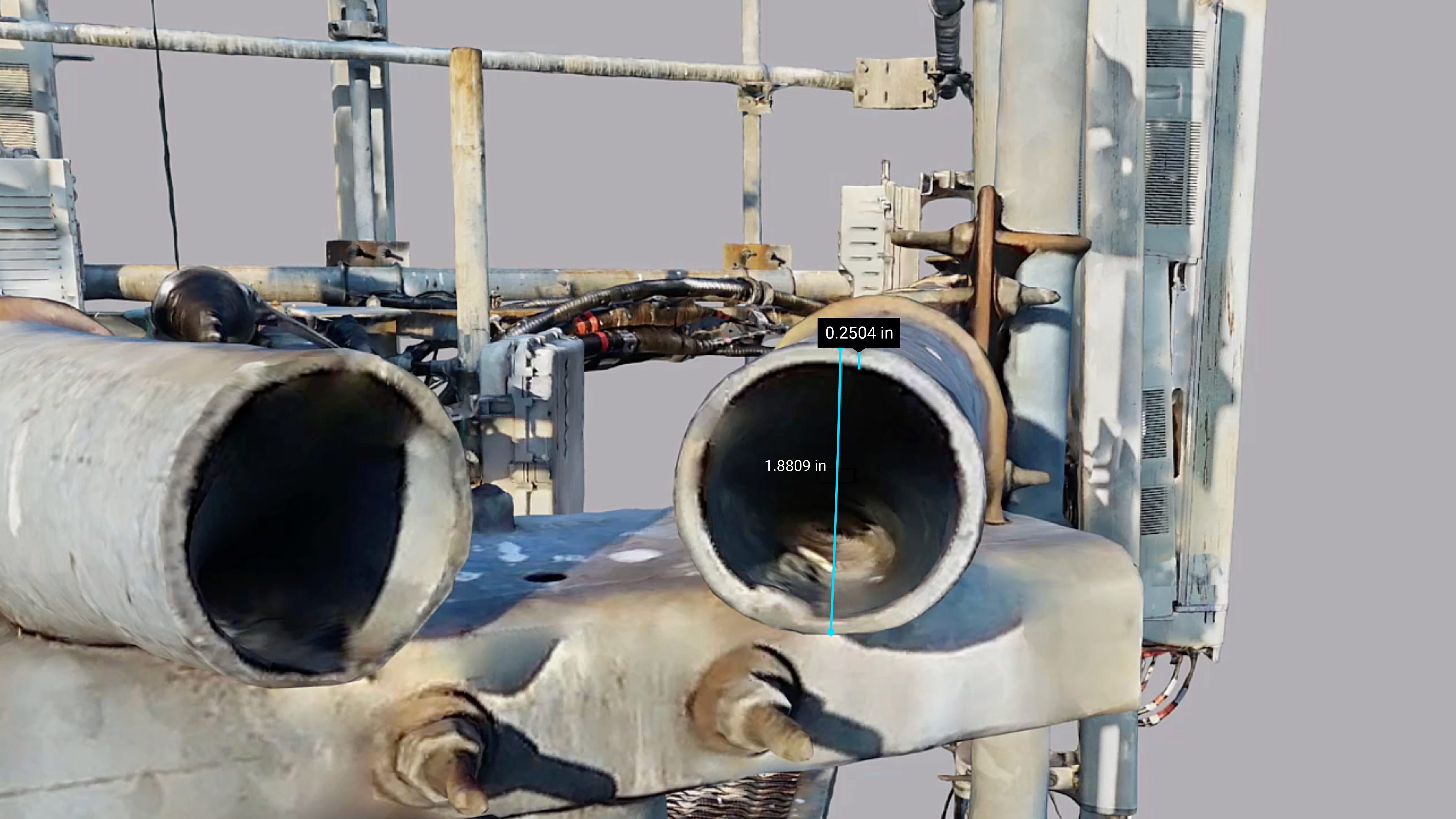
Subcentimeter Accuracy
When Precision is Critical
The 3D model is so detailed you can measure the thickness of steel, measure a cotter pin in a bolt, or the length of a cable to subcentimeter accuracy inside the model. Using our Osprey drone and the LR1 camera will result in the most accurate models but our solution can ingest photos from any platform to render your models.
Photogrammetry has enjoyed a significant advancement of its rendering techniques and rendering accuracy, and based on our experience, this is derived from the careful methodologies used in data collection. The old data quality adage, “garbage in equals garbage out” is extremely relevant here. The path of the pictures of the target assets must be programmed thoughtfully for the best quality data and image set to 3D model. Skyfish makes this easy for our customers with our best-in-class flight planning software and our powerful onboard computer, Skymind™ – Engineering grade for your meticulous data and image requirements.
