Trusted American Autonomy.
Full Stack.
Mission Ready.

![]()
Industry
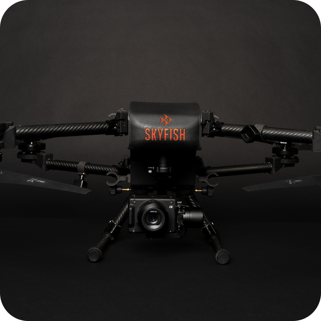
The Skyfish Osprey is a survey-grade drone purpose-built for critical infrastructure inspection, delivering high-fidelity imagery and precise geospatial data that transforms assets into measurable 3D digital twins. Powered by the Sony ILX-LR1 61MP camera and RTK-enabled accuracy, Osprey enables operators to inspect, map, and measure infrastructure with exceptional clarity and confidence. Compact, portable, and made in the USA, Osprey helps teams scale inspections faster and turn field data into actionable intelligence.
Defense
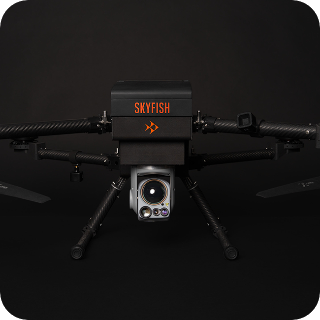
The Skyfish Osprey delivers mission-ready ISR capability in a lightweight, rapidly deployable platform designed for persistent situational awareness. Equipped with the NextVision Raptor EO/IR payload featuring up to 80x zoom, advanced object tracking, a laser illuminator/pointer for covert target marking and illumination, and day-to-night imaging from NIR to LWIR, Osprey enables operators to detect, identify, and assess critical targets with precision while helping teams see clearer, assess better, and act faster.