Author: Gabrielle Eagles
Technology is rapidly advancing in spatial data collection and two technologies are most commonly know for creating 3D models of the environment: LiDAR (Light Detection and Ranging) and Photogrammetry. While both offer incredible value, they each have distinct advantages and specific use cases where they excel. Rather than viewing them as competing technologies, it’s helpful to appreciate their strengths and consider them complementary tools for achieving outstanding results in the development of digital twins or 3D models and 2D models for surveying and mapping.
How Does LiDAR Work?
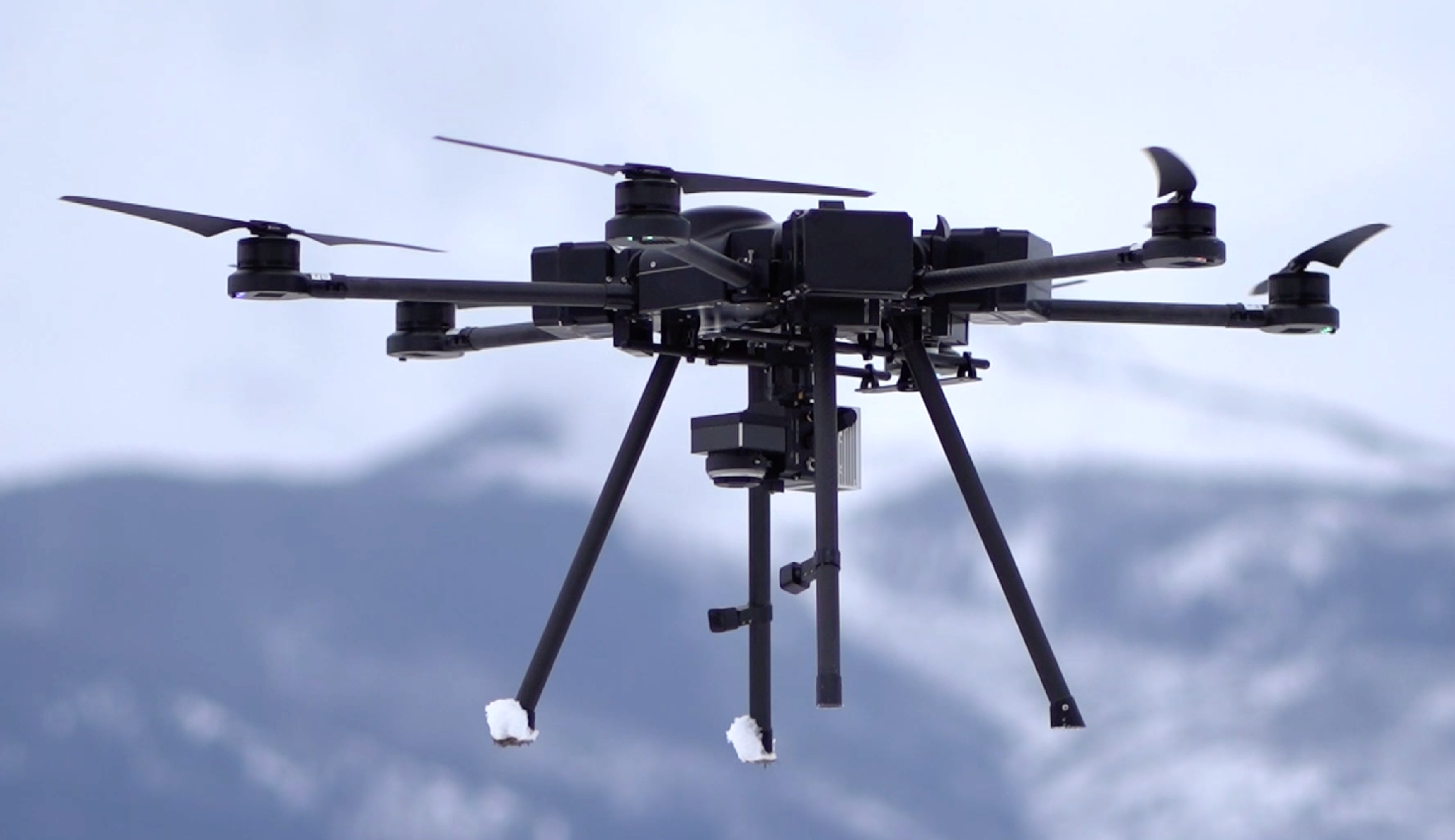
 LiDAR is an active remote sensing technology that uses laser pulses to measure distances to the Earth’s surface. By emitting thousands of laser pulses per second and measuring the time it takes for these pulses to return to the sensor, LiDAR generates a highly accurate 3D point cloud of the environment. It can penetrate through vegetation, such as tree canopies, to reach the ground, making it extremely useful in topographic mapping and forestry. A LiDAR camera was traditionally mounted on a plane to do this, then helicopters and now mostly commonly on a drone. LiDAR units are commonly heavy and require robust drones like the Skyfish M6.
How Does Photogrammetry Work?
 Photogrammetry relies on overlapping photographs taken from different angles. By analyzing these images and the differences between them, photogrammetry software can calculate the 3D coordinates of objects and produce detailed 3D models and maps.
Precision and Accuracy
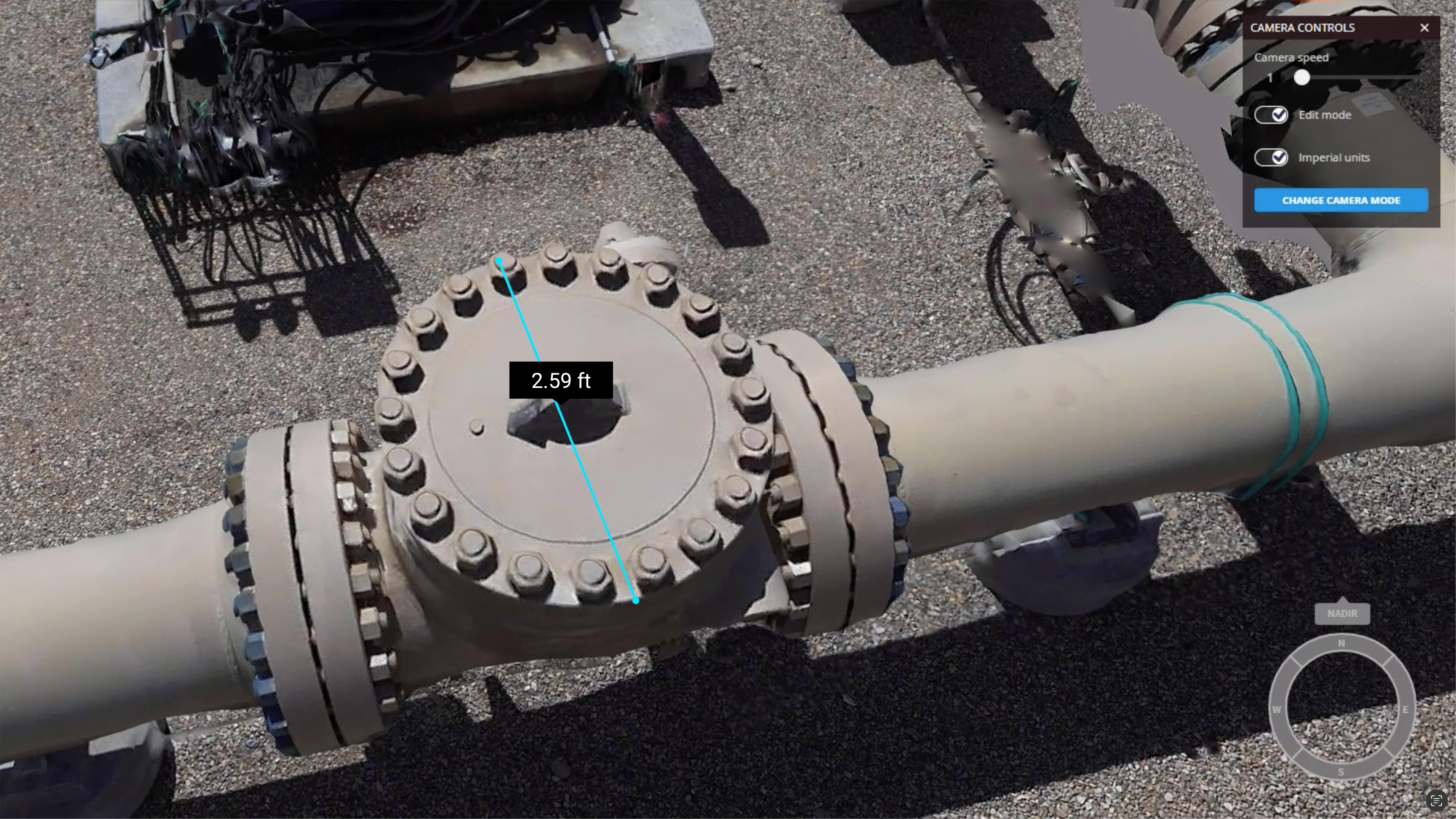
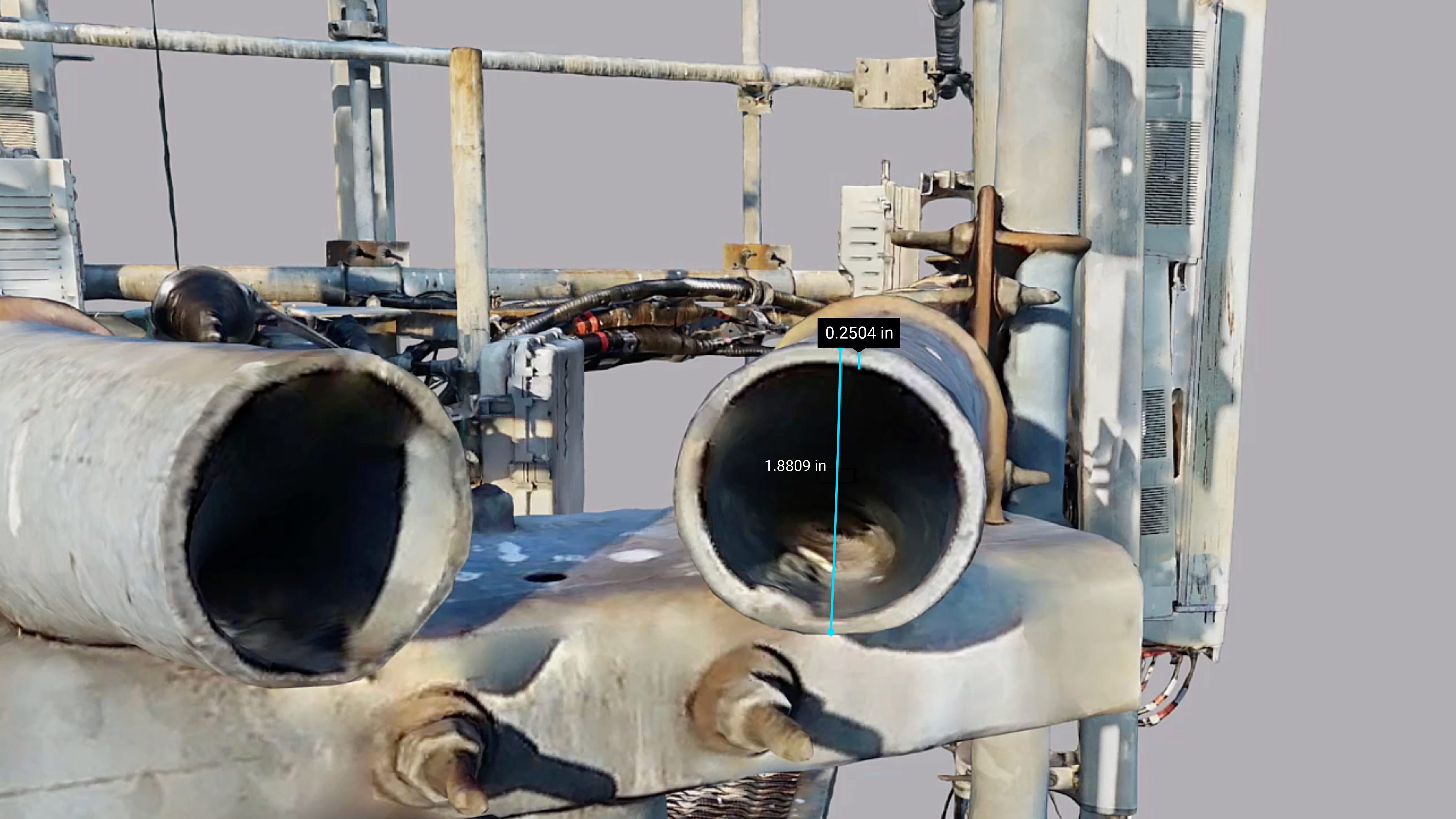
Advancements in photogrammetry technology have made this the modelling method of choice when precision and detail are required for things like cell towers, power lines, bridges and solar fields. Mounting a camera specialized in photogrammetry on a drone and integrating the two technologies, provides an unparalleled level of location accuracy needed for high end photogrammetry.
Cost and Accessibility
Photogrammetry can be more cost-effective and accessible for most organizations. When precision isn’t critical there are lower grade cameras and systems that can be found and when precision is critical, photogrammetry specific drones and cameras are also now available. The software to process photogrammetric data is also increasingly user-friendly, making it an attractive choice.
LiDAR, while more expensive, has seen a significant decrease in costs over the past decade. High-end systems are still pricey, but compact and affordable LiDAR sensors are becoming more available, especially for drone and mobile applications.
Environmental Conditions and Coverage
One of the key strengths of LiDAR is its ability to perform well in a wide range of environmental conditions. It can operate in low light or total darkness because it doesn’t rely on sunlight. Additionally, LiDAR is excellent at penetrating through vegetation, making it a go-to tool for mapping heavily forested areas, archaeological sites buried under tree cover, and other situations where visibility is limited.
Photogrammetry, however, requires good lighting conditions, typically from natural sunlight, to capture clear and usable images. It can be less effective in areas with dense vegetation because it only captures the surface that is visible from the air, such as tree canopies or buildings. That said, in open, clear areas, photogrammetry is highly efficient and can provide beautiful, richly textured 3D models that include visual data like colors and textures, which LiDAR’s point clouds often lack.
Processing and Output
 Photogrammetry has the advantage of producing highly detailed, visually realistic models with textures, colors, and features that are easy to interpret. This makes it ideal for applications that require a high degree of visual detail, such as critical infrastructure, architectural modeling and construction.
LiDAR data, by contrast, produces untextured point clouds, which are incredibly detailed but lack the visual clarity of photogrammetry models. The raw precision of LiDAR point clouds makes them perfect for geospatial and engineering applications where visual appearance is less critical than exact measurements.
When to Choose LiDAR or Photogrammetry?
There’s no clear “winner” between these two technologies—it really depends on the specific needs of the project.
LiDAR is the best choice for:
- Penetrating foliage, its value is unmatched in cases of dense canopy vegetation
- Mapping topography over large or complex terrains.
- Situations where you need to collect data in low-light conditions.
- Relies on expensive IMU technology, which integrates with real-time geotagging/computer devices that are extremely sensitive to movement.
- Requires an additional sensor and extra processing to create a less refined, less accurate model.
Photogrammetry is ideal for:
- Projects where high visual detail is important.
- Applications that don’t involve obscured elements.
- Projects where timing is of the essence, and models are needed within hours of collection.
- More forgiving than LiDAR and less sensitive to vibrations in the data gathering phase.
- Leverages benefits from advances in digital sensors, allowing for (statistically validated) better accuracy within a model with increased pixel count.
A Synergy of Both
Many professionals now use both LiDAR and photogrammetry in combination, leveraging the strengths of each to create the most comprehensive models possible. By using LiDAR to capture accurate topography and photogrammetry to apply textures and visual details, it’s possible to generate 3D maps and models that are both highly precise and visually detailed over enormous sites.
In the evolving fields of inspection, surveying, construction, urban planning, and environmental monitoring, the integration of these two technologies will likely continue to grow, offering even more robust and dynamic solutions.
Conclusion: A Collaborative Future
Both LiDAR and photogrammetry are powerful technologies with unique strengths. Rather than viewing them as competitors, embracing both tools can open up new possibilities in data collection and analysis. Whether you’re looking for precision or visual detail, these technologies can work together to deliver superior results. The key is knowing when and how to use each to best meet your project’s needs. We have found that the advancements in photogrammetry now cover about 90% of customers’ modeling needs, whereas LiDAR addresses a much smaller subset of use cases. Given the smaller subset, LiDAR can have a higher cost of ownership.
See Skyfish Drones and Photogrammetry Solutions.