Transportation Infrastructure Inspection
Measure Every Crack
Cover miles of ageing transportation infrastructure with fewer resources and greater accuracy using drone-enabled photogrammetry.
More data, greater accuracy
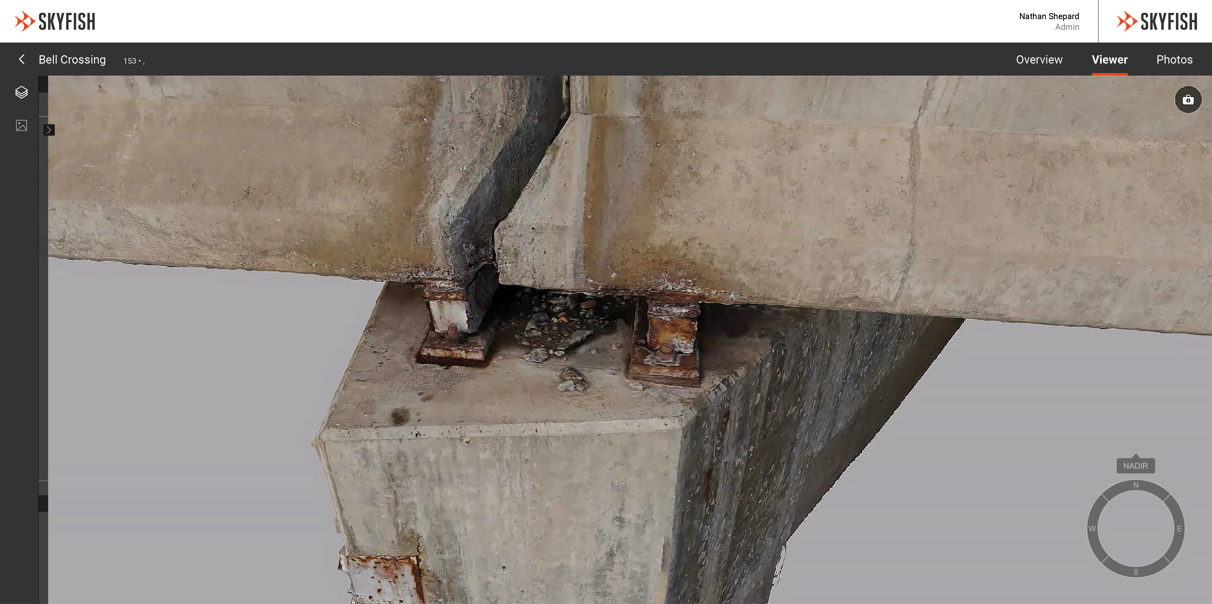
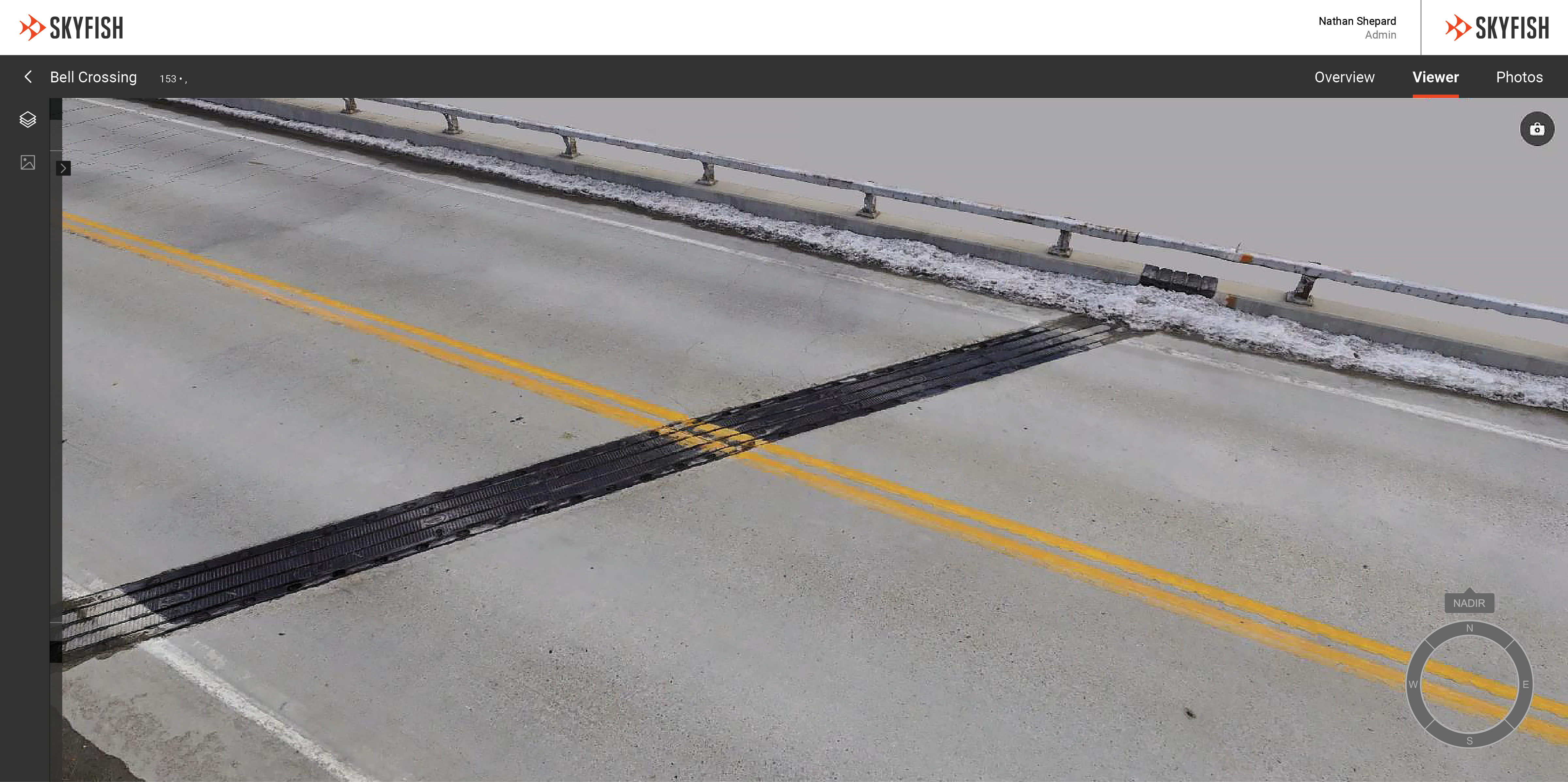
Model Bridges
Survey-grade 3D models engineers can use to get various angles of a bridge – from structural damage to bridge geometry. Within the model, teams can make focused, precise measurements, identify maintenance needs, generate reports, and export to an array of file types.
The data you need within hours of collection
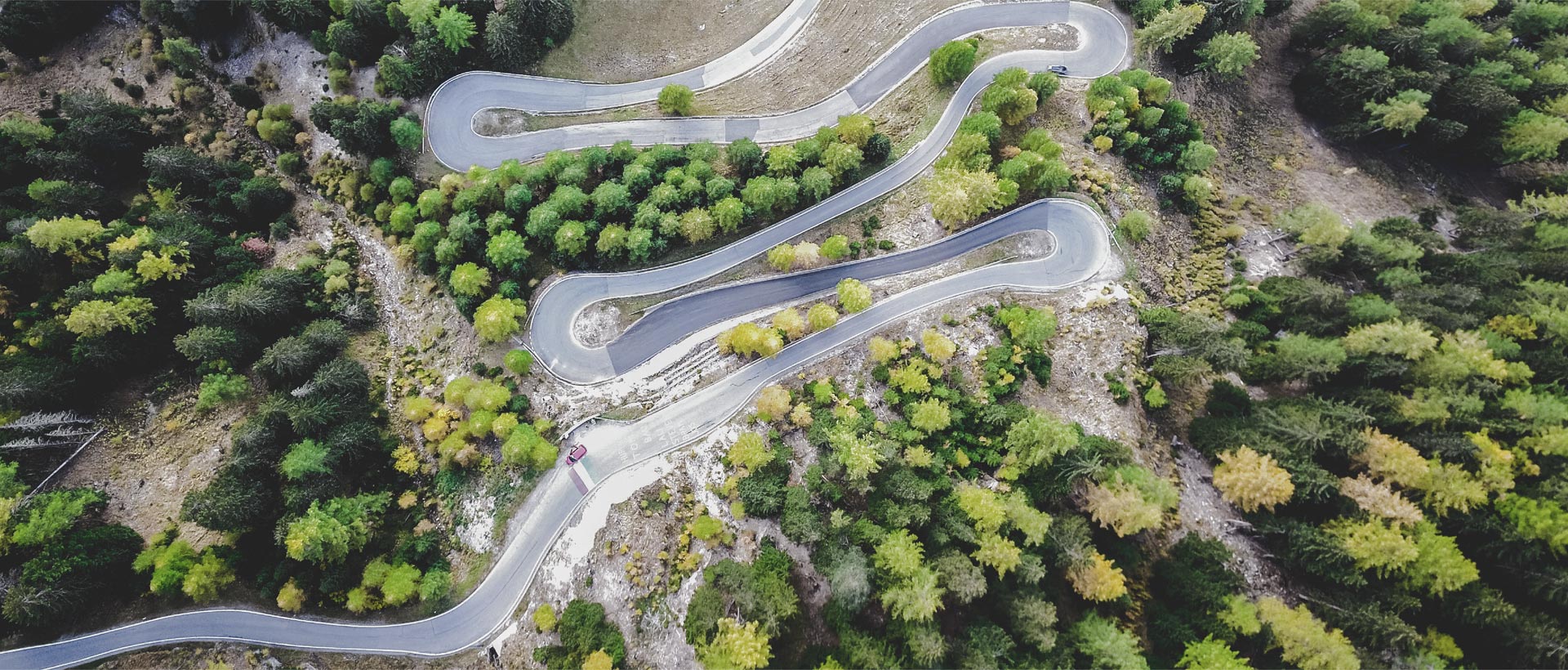
3D Roadways & Runways
Long stretches of roadway, runway and sidewalk can be time consuming to evaluate. Lower operational costs with AI supported photogrammetry that can auto detect deterioration in less time and with greater accuracy.
Improve safety and compliance
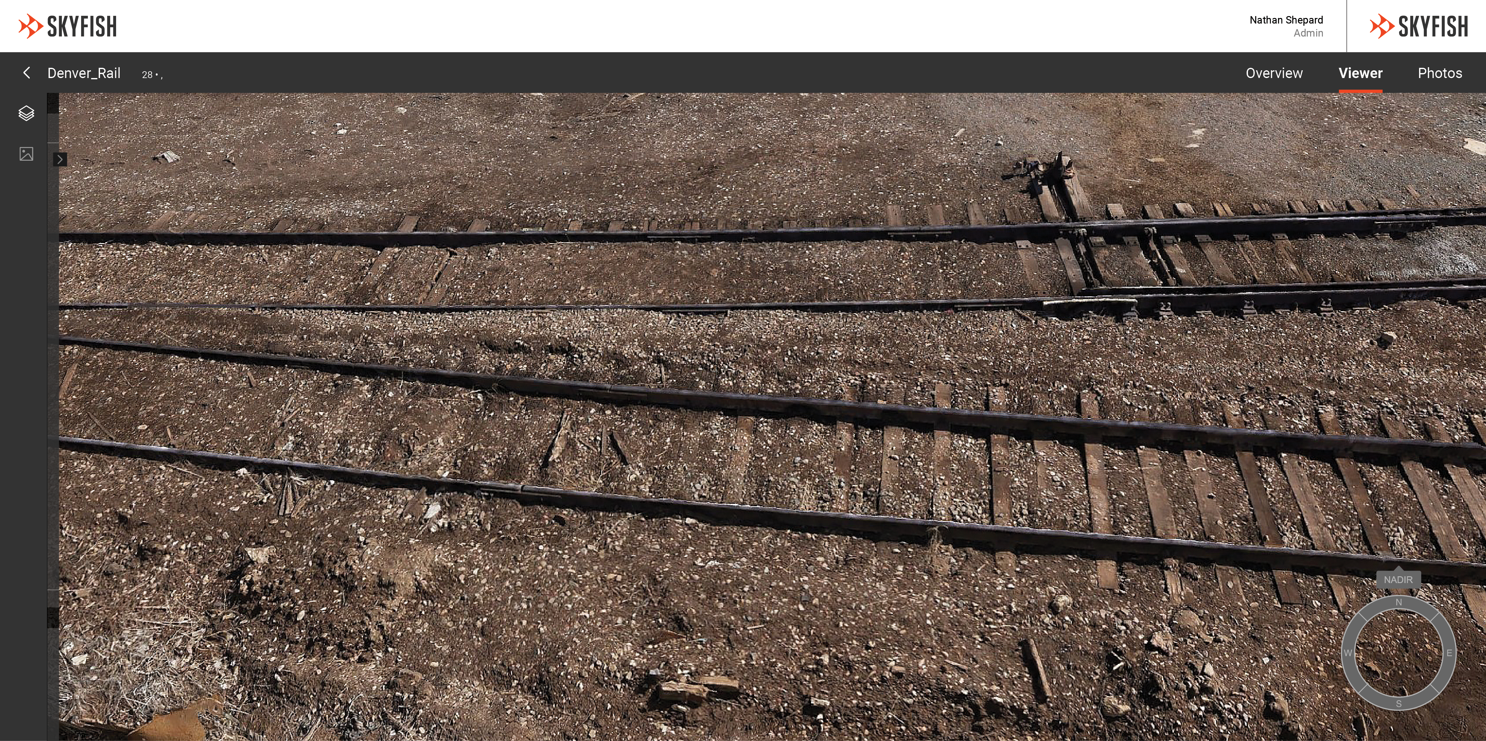
Railway Digital Twins
Reduce worker injuries with drone-enabled photogrammetry. Provide engineering teams pristine digital twins of rail lines, containers, depots and signals that are measurable and accurate up to 1/32 of an inch.
Transportation related structures
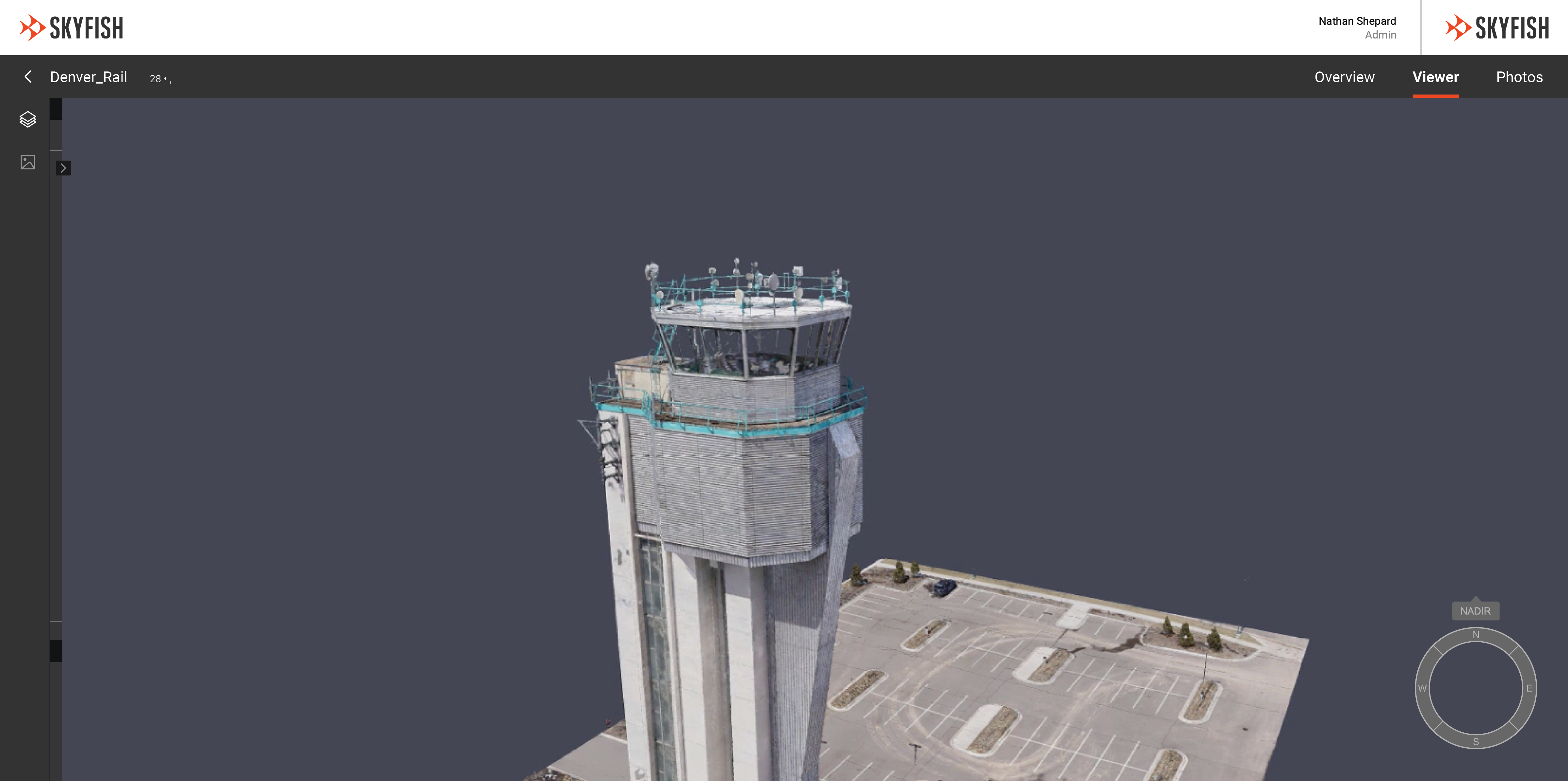
Towers & Buildings
Signs, towers, buildings and other structures related to transportation also deteriorate. Skyfish’s AI technologies can comb through thousands of miles of data to identify degradation and ID risks to engineers. The Skyfish drone platform can also automatically create the optimal flight path for circumnavigate structures like air traffic control towers to capture the data needed to analyze these vital structures.
Flight Path
Flight path automation provides the right photos for pristine digital twins.
Drones
The Osprey drone is specifically designed for photogrammetry and is tightly integrated with all components to ensure you get the highest quality data available.
Digital Twins
Get a 3D model and its related data within hours of collection from Skyfish’s photogrammetry software.